|
SBI Route 21 was Antioch to Chicago via the following current routes:
IL-21 runs in Cook and Lake Counties. |
 |
SBI Route 22 was originally a loop around the area, called the "22 Loop" on the following current routes:
IL-22 today goes Highland Park to Fox River Grove in Lake and McHenry Counties. IL-22 is planned to be improved to 4 lanes for most of it's current length to alleviate huge traffic jams. NIMBY problems in Lincolnshire slowed things down, but in 2003 IL-22 is finally beng upgraded to 4 lanes on the east end. In 2006 the Lake Zurich bypass to the south of the town center was opened, while work continues east of there thru Hawthorn Woods, Long Grove and Buffalo Grove. |
 |
IL-22A was Dundee to Barrington, on what became IL-63, then IL-68. This was only shown on the 1924 Illinois map. |
 |
SBI Route 23 was the same as IL-23 today, Harvard to Pontiac. IL-23 goes thru McHenry, DeKalb, LaSalle, and Livingston Counties. |
 |
SBI Route 24 was East Peoria to Pana, now part of current IL-29. By 1940 it changed entirely to IL-29 and has not been used since. |
 |
I-24 runs from a bridge over the Ohio River near Metropolis to I-57 near Goreville. The far eastern end of I-24 is at I-75 in Chattanooga TN. It runs for about 34 miles in IL. While looking at I-24 just in IL, one may wonder why it was ever built, or why was it not extended directly to St. Louis, but if you look at it in the grander scheme of things you will see that it fits in pretty nicely for traffic heading SE towards Atlanta, Florida and the SE coast. By using I-64 and I-57, traffic from St. Louis has a pretty decent route to the SE. That explains why St. Louis is used as a control city on I-24 even though I-24 does not go there directly. I-24 does violate one of the sacred rules of highway numbers, having the same number on a US highway as an interstate in the same state. US-24 runs thru IL as well, but a couple hundred miles north. While no confusion is made because of this transgression, this is the only place in the US that I know of where this occurs. (There is an extension of I-73 and/or I-74 that may cause a conflict in the SE US soon though) |
 |
US-24 runs from the IN line at Sheldon to MO at Quincy. US-24 has not changed much over the years, just a relocation from thru Canton to east of there in 1937 and a relocation east of Peoria in the 1990's. The old route thru Washington was changed to IL-8 in part, and then in 1997 was changed to Business-US-24. |
 |
Business US-24 is the old route of US-24 from east of Washington thru town, it was IL-8 from 1995 to 1997. In 1997 it was changed to Business US-24. |
 |
SBI Route 25 was Kankakee to Fairfield, now part of US-45. IL-25 runs from Carpentersville to Oswego in Kane and Kendall Counties, and has not changed since the late 1930's. This is on the east side of the Fox River (IL-31 runs on the west bank) |
 |
SBI Route 26 was Freeport to Polo, on part of current IL-26. 1937: IL-26 was extended Freeport to the WI line, in place of IL-74, and extended Polo to Bureau along US-52 to Dixon, and replacing IL-89 Dixon to Bureau. In 1969: Extended south to East Peoria replacing IL-87. IL-26 was rerouted onto the nearby I-180 bridge over the Illinois River near Hennepin during the 1990s. The older IL-26 bridge, half a mile south of I-180, was removed after 1999. the old approaches are now local roads, used mainly as access to riverside industries on both banks. IL-26 runs from the WI Line north of Freeport to East Peoria thru Stephenson, Ogle, Lee, Bureau, Putnam, Marshall, Woodford and Tazewell counties. |
 |
SBI Route 27 was Savanna to Polo, now part of US-52. It has not been used since the early 1930's when it was pulled in favor of US-52. |
 |
SBI Route 28 was Sheffield to Galesburg, now part of US-34. It was pulled in the 1930's in favor of US-34. It has not been used since |
 |
SBI
Route 29 was DePue to Peoria, on part of current IL-29.
IL-29 currently runs from Spring Valley to Pana in Bureau, Putnam, Marshall, Peoria, Tazewell, Mason, Menard, Sangamon, and Christian Counties. |
 |
SBI Route 30 was:
Not used since 1941. |
 |
US-30 has gone thru many changes over the years. Originally it ran from Fulton IL east to Chicago and into IN on the following current day routes: US-30 Fulton to Sterling, IL-2 Sterling to Dixon, and IL-38 Dixon to Bellwood. From Bellwood to Indiana it ran on various city streets including Roosevelt Road and Stony Island Av. In the 1930's it was rerouted to a new road south of the original, pretty much on its current route to IN at Lansing. This process took several years, and went like this:
In 1971 this Alternate US-30 became IL-38 west of US-12/US-45. East of here the number was removed. The portion of IL-31 from Aurora to Geneva was US-30 for a while, after US-30 was rerouted south of Chicago (thru Joliet) and before it was rerouted west of Aurora. IL-31 north of Geneva was US-430 at this time, and US-430 was changed to IL-31 before or at the same time as US-30 was rerouted west of Aurora. In the 1950's a new approach to and bridge over the Mississippi River was built and the old road became Alternate-US-30, then IL-136 (since the matching IA road was IA-136). Also in the late 1950's US-30 was rerouted around Aurora, and the old road became City-US-30 then Business-US-30, and now is unnumbered. In 1971 the parts of Alternate-US-30 west of Bellwood (US-45) became IL-38, the rest lost the numbers altogether. During the period 1963 to 1965, if one drove south on IL-31 from anywhere north of St. Charles to Oswego he would have crossed in succession: Alt-US-30 (now IL-38, and formerly US-330), Toll-US-30 (now I-88), Bus-US-30 (now Galena Blvd.), US-30 (still US-30). At the same time he would have been on what was once known as US-430 north of Geneva and US-30 south. |
 |
Alternate US-30 (East) There were 2 sections of Alternate US-30. The main one was Sterling to the IL/IN line at what is now IL-83, which had been US-30 prior, then US-330. Alternate US-30 was changed to IL-38 as part of the "Great Purge" of the early 1970's. |
| Alternate US-30 (West) The second Alternate US-30 was only in Illinois west of Fulton to Clinton IA after a new bridge was built over the Mississippi River. This is now IL-136 (and IA-136 west of the river) | |
 |
Business US-30 was the old route of US-30 thru Sugar Grove and Aurora that had been City US-30 for 1959, and US-30 before that. In 1960 it became Business US-30 and the number was removed in 1970. |
 |
City US-30 was the old route of US-30 thru Sugar Grove and Aurora that had been US-30 until 1959. In 1960 it became Business US-30 and the number was removed in 1970. |
 |
Toll-US-30 was the East-West Tollway (from I-294 to Aurora), built in 1963 as Toll-US-30, until 1965 when it became IL-190. For that short time, Toll-US-30 was routed along I-294 south from the E-W to what is now IL-394 to US-30, at least on the state highway maps. It eventually became IL-5, and is now Interstate 88. |
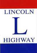 |
Lincoln
Highway
The Lincoln Highway runs from Coast to Coast, and in Illinois more or less followed the original US-30. US-30 was rerouted, and the current route of the original Lincoln Highway is as follows:
Several towns have posted Lincoln Highway markers along the road, including some hand painted replicas of the original pole markers. Rochelle has pole banners, and many towns still call the road Lincoln Highway. The Lincoln Highway Association has a ton of information on this route. |
 |
SBI Route 31 was Quincy to Canton via
IL-31 runs thru McHenry, Kane and Kendall Counties. |
 |
SBI Route 32 was Decatur to Windsor. In 1936 IL-32 was extended to Effingham in place of IL-129/SBI-129 on this route. In January 1998 IL-32 was extended north 7 miles to Cisco (and the junction with IL-48) |
 |
US-32 was the original number for US-34 from Chicago to Princeton, then US-6 from Princeton into Iowa. It was changed in the mid 1930's to its current numbers. |
 |
SBI Route 33 was Effingham to Gordon (Near Robinson).
In the 1960's it was extended slightly west on a stretch of former US-50, after US-50 was upgraded to a freeway. |
 |
SBI Route 34 was a "T" shaped route from Harrisburg to Elizabethtown, and a leg to Golconda. The portion from Golconda to and thru Elizabethtown is now IL-146. In 1937 IL-34 was extended NW to Benton on the former IL-143, and the southern end was moved to Rosiclare. There was once a ferry operation to KY-297 from IL-34 just west of Elizabethtown. This ended in the mid 1960's. |
 |
US-34 started out in Chicago (As Ogden Av.), and was best known as the "Other Number" on Route 66 with which it was co-located from Chicago to Berwyn. It heads west from its current east end at Berwyn (IL-43, was IL-42A) to Burlington IA. There have been no other major changes. Until the Mid 1930's the eastern half of this route in IL had been US-32. |
 |
SBI Route 35 was the short connection from Mound City to the current US-51, slightly over 1 mile. This served a federal cemetery. This was changed to IL-37 as an extension of this route in 1935. IL-35 is now a 3 mile long route from the WI line to East Dubuque that had originally been IL-79 until 1938. From 1971 to 1982 US-61 and US-151 also ran on this route to the US-20 bridge due to a bridge closure just north of the IL/WI state line that had taken these routes into IA. |
 |
SBI Route 36 was Carthage to Jacksonville over the following routes: IL-94, Carthage to Bowen, IL-61, Bowen to Ursa, L-96, Ursa to Quincy, US-36, Quincy to Jacksonville. In the mid 1930's it was shortened to only Bowen to Carthage, and in 1937 dropped altogether. |
 |
US-36 runs from the IN line at Raven (east of Chrisman) to MO south of Quincy. From Decatur west it is collocated with I-72. The original routes from the Mississippi River to Winchester is now IL-106, from Winchester to near Decatur are now unnumbered county roads. |
 |
SBI Route 37 was Mt. Vernon to Marion. In the mid 1930's IL-37 replaced IL-147 from Marion to Cairo, and IL-142 Mt. Vernon to Effingham, making IL-37 Effingham to Cairo. The first few miles out of Effingham were co-located with US-45, and this was dropped after the completion of I-57 in the early 1970's. In 1999 IL-37 was extended south a few miles on the old route of US-51 when US-51 was relocated to I-57 south of Dongola. I-57 parallels IL-37 most of the way to Cairo. |
 |
SBI Route 38 was Kampsville to Jerseyville over the current IL-100 (Kampsville to Nutwood) and IL-16 (Hardin to Jerseyville).
In 1972 IL-38 replaced Alternate-US-30 from Dixon to Bellwood. The rest of Alt-US-30 was eliminated. |
 |
SBI Route 39 was Bloomington to Champaign. This route is now part of US-150 and IL-39 has not been used since |
 |
I-39 runs from I-55 near Bloomington to Wausau WI. The section from Rockford IL to Portage WI is just now being posted after not being so for several years. This section had always officially been I-39 (at least since I-39 was posted in WI several years ago) but not posted until recently. This had been considered for I-43, as the current I-43 ends just a few miles north of the IL line. This route was an upgrade to US-51. In IL, US-51 has been moved to the Interstate, and most of the old road was changed to IL-251. In WI, US-51 is a separate road from the state line to Portage (As I-39 was routed over the existing I-90/I-94). North of Portage the road was upgraded in place and US-51 remained on the new road, although there are older alignments scattered about. A future idea is to extend I-39 south. This would not be very difficult, since US-51 is already a 4 lane divided highway from the Bloomington area to Decatur. There has been speculation of extending I-39 to Decatur, running it around the East side of town to finish the loop, then going to either Vandalia or Effingham. If they go to Vandalia, then a logical extension of this would be to I-57 at Salem. This would allow traffic from the South to head north without heading towards Chicago. IDOT has no current plan to extend I-39 south of Bloomington at this time though. Steve Sarver of Kirkland IL writes about I-39 (2001): Portion from
U.S. 20 near Rockford to IL-5 near Rochelle was opened in 1984. It was
opened from IL-5 to I-80 in the fall of 1986. In December 1987, the section
from I-80 south, across the Illinois River, was opened and its southern
terminus was IL-251 (old U.S. 51). It was not open from IL-251 to IL-71.
At one mile in length, the bridge is the longest in Illinois. It is named
the Abraham Lincoln Memorial Bridge. |
 |
SBI Route 40 was Sterling to Mt. Carroll. In 1938 IL-88 replaced IL-40 as an extension of that route. In 1995 IL-88 was changed to IL-40, and extended from Peoria to East Peoria over the new bridge between the two cities since IL-88 conflicted with I-88 after IL-5 was changed to I-88 in 1992. |
 |
US-40 runs from Terre Haute IN to St. Louis thru IL, and is paralleled by I-70. This is the "National Road" east of Vandalia. There are several places where US-40 has been replaced, and the old road is unnumbered except for Vandalia to Greenville where the old road is part of IL-140. (The part of IL-140 west of Greenville was considered a spur of US-40, thus the number IL-140). Parts of US-40 are also on I-70, in the East St. Louis area, for about 6 miles east of Pocohantas, and for a couple miles at the IN state line. |
 |
Alternate US-40 was used on the old route of US-40 from East St. Louis to Collinsville (Vandalia Ave and Collinsville Rd.). This route was US-40 until 1962, changed to Alternate US-40 in 1963, then Business US-40 in 1964. Business US-40 was removed in 1974 as part of the Great Purge. Alternate US-40 was also used on old sections of US-40 during the 1960's from near Greenville to Vandalia. Most of this route is now IL-140. |
 |
Business US-40 was on the old route of US-40 from East St. Louis to Collinsville (Vandalia Ave and Collinsville Rd.). This route was US-40 until 1962, changed to Alternate US-40 in 1963, then Business US-40 in 1964. Business US-40 was removed in 1974 as part of the Great Purge. |
 |
Bypass US-40 was Troy to Granite City, then across the Mississippi River into MO on the Chain of Rocks Bridge, until parts of it became I-270 in the 1970's. |
 |
On the 1939 and 1940 IL maps there was a "Belt Line" US-40 shown from US-40 north of Collinsville to west of Collinsville on what is now Belt Line Road. In 1941 US-40 was rerouted on the former Belt Line and the old route became City US-40. |
 |
(See Belt Line US-40) |
|
Send updates to n9jig@n9jig.com |
Updated
11-18-2007 |